Home » Uncategorized » Page 32

Category: Uncategorized

Field Guide: Developing a Community Based Disaster Risk Reduction Plan

It is estimated that over 50% of all disasters are now related to extreme weather events. Because of this, disaster risk reduction should become an integral part of adaptation projects. Community-based disaster risk reduction (CBDRR) holds the same merit that community-based adaptation does: ownership and sustainability. This field guide presents an overview of establishing a CBDRR program in a community.

Conducting a Participatory Capacity and Vulnerability Analysis.
In chapter 2 you conducted in a participatory capacity and vulnerability analysis as part of developing your community-based adaptation project. Use the same resources that you found in that chapter—yet focus the assessment on hazards and disasters. Examples could be floods or extreme weather events such as hurricanes. One of the exercises is to do a participatory map. It is useful is to transfer the information from the map into a larger format on a public wall where everyone in the community can see it and better understand how disasters can impact their village.

 Setting up a Community-Based DRR Committee 
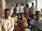
In chapter 7 you set up a community-based project management committee. You can use the same technique to set up a community-based DRR committee. This committee will be able to coordinate with your NGO and then create long-term associations with government agencies that can continue to support DRR activities. The committee will be in charge of developing a DRR plan—and of coordinating disaster teams.

Developing a DRR Plan
Developing a DRR plan will include the development of each of the following list of activities and maintaining them in perpetuity. This will involve a plan for consciousness raising among community members about DRR challenges, connecting with an early warning system, the organizing of teams, training them in evacuation and search and rescue, and prioritizing mitigation strategies—and for training community members to implement mitigation activities.

Organization of Teams
Based upon the results of your community’s PVCA, they will have prioritized hazards and disasters. As part of their DRR plan the committee will have prioritized preparedness activities, reduction in risk activities and mitigation activities. If, for example, the type of disaster your community faces necessitates evacuation, an evacuation team should be established that develops a plan to lead the evacuation at the appropriate time. You should do this for each of the major priorities in the plan.

Promotion to Community
Frequently community members don’t have a clear picture of how and why disasters happen. They also may not know how to react when the disaster is building or is already in progress. Workshops and simple posters or how-to cards—without words—need to be developed to help them understand these concepts and to learn that there are things that they can do to reduce the risk caused by disasters, and mitigate the severity of the disasters.

Early Warning Systems
Traditionally, community members have not had warning of when they need to evacuate—and frequently they have left it too long. The government meteorological office may have the capability of, for example, in a potential flood situation, evaluating when water has reached a critical height and have the capability of announcing that a flood is imminent. Communities should form partnerships with these offices and purchase dedicated telephones and alarms.

Evacuation Training
If people need to evacuate, they need to know when to evacuate, they need to know where to go where it’s safe, they need to know what to do with their valuable possessions and assets, they need to know what to take with them, and they need to know what to do when they get to shelter. Capacity building workshops can train community members in each of these—and most importantly—can lead them in practice drills.

Search and Rescue Training
Search and rescue team members learn specific techniques that are safe, and are given simple tools such as lifejackets, safe boats, inner tubes, and flashlights which give them the confidence and the capability to look for a missing person or of rescuing a trapped, elderly or disabled person.

Capacity Building for Disaster Mitigation Activities
There are many things that can be done to mitigate potential disasters. Some, like plantings along the river banks can reduce erosion during a flood season, or the reforestation a watershed can reduce danger from flash floods and are activities that communities can do over the span of time. Capacity building workshops give community members the skill sets that they need to do these activities. Others like relocating houses to higher ground or building bridges may be outside of their purchasing power, but committee members can be trained to develop advocacy campaigns for approaching governments for support for these more major investments.

Field Guide: Simple Techniques for Soil and Water Conservation

Subsistence farmers suffer not only from depleted soils but from challenges with water: too little water, too much water, and erosion from water. This field guide looks at different ways of managing water and conserving soil by developing barriers on farm fields for stopping the flow of water so that it can percolate into the soil and build up soil moisture. The barriers also reduce the loss of soil from erosion.

Barriers to Water Movement
On sloping farm fields, creating barriers reduces the speed of water movement so that it can be absorbed into the soil rather than simply running off the land. These barriers also catch topsoil that the water carries preventing the loss of this valuable resource and offer the added benefit of creating level planting areas behind the barriers as the soil accumulates. Barriers can be terraces, stone or earth walls called bunds, or living barriers such as hedges and grass strips.

Building terraces and stone retaining walls can be very labor intensive. Less formal constructions such as soil bunds, hedgerows or rows of grass can be less labor-intensive and potentially more attractive to farmers. Construction can be spread out over several years.

One thing that all barriers have in common is that they run horizontally along a level contour across the falling slope of a field. An A-frame leveling device is used to determine the level contour lines which are marked with stakes or with stones.

Here are four techniques for farmers to consider. The technique chosen by each individual farmer will be based upon how steeply a farmer’s field slopes, how big their field is, whether they are in a high rainfall or low rainfall region, and how much time they have available for investing in the technique.

Contour Ridges.
Ridges with furrows on the uphill side are formed approximately 1.5m to 2m apart. This 2m area is the catchment area for rainwater. The ridges are only 15 to 20 cm high—simply high enough to contain the run off—which collects in the furrow. Crops with higher water requirements can be planted close to the side of the furrow. Contour ridges represent the least time investment of these four techniques and can be developed, maintained and improved during preparation for each planting season.

 Soil Bunds
Soil bunds are a method for both containing water and reducing erosion using on-site materials. After marking the horizontal contour line on the sloping field, a ditch 60 cm deep and 60 cm wide is dug. The soil is placed on the downhill side of the ditch creating the soil wall. The base of the wall is typically twice as wide as the wall is high. The soil is well compacted by hand.

Soil bunds are placed from between 5m apart on steep land to 20m apart on more gently sloping land. To determine spacing between the bunds, one rule of thumb is that the top of one bund is level with the base of the adjacent uphill bund. However farmer preferences and the size of the farmer’s field are other determinants.

Fodder grasses, trees and crops are planted on the bund to stabilize it. Water collects in the ditch during rainstorms and can slowly percolate into the soil increasing soil moisture. As rainwater erodes soil uphill of the bund, the soil will accumulate above the bund and begin creating an increasingly level planting strip. Soil bunds will need annual maintenance—and will need to be checked after heavy rainfall and breaches repaired immediately.

Hedgerows.
Hedgerows can also be planted along the contour lines of a hillside—in similar spacing as soil bunds depending on the steepness of the slope of the field. Hedges are usually chosen from nitrogen fixing plants, and from plants that when pruned can be used as fodder for farm animals. Initially, these cuttings can be laid at the base of the hedges on the uphill side to trap eroded topsoil. After two or three years, sufficient topsoil will have accumulated to form a terrace uphill of the hedgerow. Hedgerows represent substantially less time investment than soil bunds—and use less space making more land available for planting.

Vetiver Grass Strips.
An inexpensive alternative, vetiver grass can be planted along the contour line of a sloping field to prevent the loss of topsoil, and to reduce the rate at which water runs downhill enhancing infiltration. Topsoil builds up on the uphill side and over time creates level planting areas. Grass strips represent substantially less time investment than soil bunds—and use less space. Grass strips need to be maintained over time to keep them from encroaching into the cropping areas. Grass trimmings can be used as fodder. Vetiver grass is very popular, but check with farmers for local favorites.

Conclusion.
Upon completion of this workshop discuss with the farmers which technique would be best suited for them. Then plan a second more specialized training workshop for that specific technique.

Field Guide: Participatory Mapping for Soil and Water Resources

Participatory mapping is an excellent way of learning in greater detail about the community, their resources, the hazards they face, and how the village, farm fields, roads the hills and water sources interrelate. It’s also an excellent method for community members to see things they take for granted every day through a new lens. Participatory mapping is an inclusive tool because all workshop participants can engage in the activity and it’s very visual—non-readers will not be excluded.

 Getting Started

Consider returning to the village the day before the workshop to tour the farm fields, forests, and water sources with one of the villagers. Take a few minutes to talk to people you meet in order to gain a greater understanding of the scale of the community and to get a better sense of some of the challenges they are facing.

The purpose of the workshop is for community members to understand the impact of sun, wind, runoff, crop selection, location of water sources, floods, drought, and variable rains.

Draw the community map on a sheet of newsprint—or several sheets taped together. Begin by drawing a very simple drawing of the spatial relationships between the different parts of the community and how the village relates to the farm fields, hills, very steep hills and sources of water. Mark where transportation routes are—including roads and pathways. One suggestion is to quickly draw a preliminary map, make corrections and adjustments, and then transfer the revised map information to a fresh sheet of paper for further development.

Be sure to include:
-farmlands and their relationship to the village
-sources of household and agricultural water and their relationship to the village/farmlands
-rivers and streams
-the location of steep hillsides or canyons
-the location of main roads and pathways
-the location of what crops are grown where
-community land, forest boundaries, grazing/pasture lands

When everybody at the workshop is satisfied with the basic map, you can begin indicating other useful information on the map. It’s a good idea to represent buildings and farmer’s plots using piece of colored paper that can be attached to the map with removable tape so they can be moved or adjusted; by removing these bits of paper completely the map can be used again for a different assessment.

When everyone is satisfied that the map is accurate, introduce the idea of hazards that the community suffers. These hazards could include extreme weather events, floods, heavy rainfall, drought and landslides. The information that we want from this part of the exercise is which parts of the community, which people, which personal assets, which environmental resources, and which livelihoods are the most vulnerable to the hazards as identified on the hazard map. Examples could be:
-farmlands vulnerable to drought (or insufficient access to water)
-farmlands vulnerable to flooding, too much wind exposure and other weather related hazards
-areas with too little or too much sun
-areas that suffer from excessive runoff
-farmer perception of the fertility of their soil: good, medium, or poor

Conclusion: To discuss and reinforce what has been learned and to discuss.
1. Discuss and review what has been learned.
2. Reinforce the soil and water challenges farmers face that were identified during the mapping exercise.
3. Discuss whether hazards such as, floods, variable rainfall and drought impact soil and water resources. Introduce the following questions:
-Are the hazards concentrated in one area of the community?
-What negative impacts will the hazards have on community members and their assets?
-What is a prioritization of the community’s greatest hazards they face?
-Who in the community is the most at risk from the hazards?
4. Summarize a list of the challenges and hazards farmers face in preparation for next week’s visit by extension agent.

Note:
What are the community members’ current coping strategies for dealing with these difficult periods?
Capacity building: Which of the difficult events are they having trouble coping with due to a lack of strategies?