Home » Archives for Tim Magee » Page 10

Author: Tim Magee

April CBA News: Climate Smart Ag | S. Sudan | Tanzania | St. Lucia | Kilimanjaro | Mozambique | Soil Stewardship | CBA Resources

April CSDi Newsletter
Special Issue: Climate Smart Agriculture
Climate Smart Ag | S. Sudan | Tanzania | St. Lucia | Kilimanjaro | Mozambique | Soil Stewardship | CBA Resources
 
THIS MONTH’S NEWS

The theme of this month’s newsletter has a special focus on climate smart agriculture for smallholder farmers to address the fact that so many partner projects have a basis in challenges with agriculture for subsistence farmers.

South Sudan

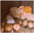
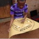
Piotr Barkzak (Poland/Belgium/South Sudan) was called to South Sudan in the fall. Poitr is an environmental lobbyist in Brusselsbut also has experience working in Africa.

He has been working on a project in Jonglei State developing an ecologically sensitive agricultural program for 60 farming families. He prepared a brief final report in English in March for those of us in the CSDi community to enjoy. Here is a link to his report so that you can learn more about his project and look at a greater range of photographs.

 
Tanzania
Adaptation Through Conservation Agriculture

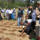
Chris Enns (Canada), has been working on a project in the community of Wagete in the Region of Mara, Tanzania. 4,000 community members are suffering from reduced crop yields due to unpredictable weather patterns related to climate change. Chris launched a farmer soil and water conservation program, and led a very comprehensive conservation agriculture workshop. You can link to a report of the workshop complete with detailed photographs of the conservation agriculture techniques they used.

 
Saint Lucia
Adaptation, Agriculture and Livelihoods

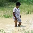
Brenda Wilson (Saint Lucia), has been working on a project in the community of La Pointe, Micoud, St. Lucia. Households are suffering from low incomes from reduced crop production due to changes in weather patterns bringing extreme weather events such as hurricanes, and an increasingly unpredictable beginning and end to rainy season.
 
Brenda recently completed the development of a community Climate Smart Agricultural Community Management Committee. Download Brenda’s report.


Mozambique Finding Climate Smart Agricultural Solutions to Famine
Phipps Campira (Mozambique), Zipo Akinyi (Kenya/New Zealand), and Lenneke Knoop (The Netherlands) have been working on a project in the community of Mezimbite, Mozambique. 566 households (3,400 people) are frequently suffering from famine caused by a lack of knowledge of improved agricultural practices and climate change related unpredictable rain and extreme weather events.
 
The team developed this project outline to increase crop production, reduce malnutrition, improve food security, and reduce mortality rates among children and the community. Download their scientific research on project activity effectiveness.
 
Kilimanjaro Extreme Weather Events and Recurring Drought Create Food Insecurity for 1300 Households
Since 2007 there has been severe drought and crop failure in the Kilimanjaro regionmostly in Moshi rural, Rombo, and Lower Hai and Mwanga districts. This has led to difficult livelihood challenges among community members; housing and food security are also challenges.
 
Minja Gileard Sifuel (Tanzania), Gemi Montecchi (Italy) and Ellen deGuzman (US) have been developing a project which includes a soil restoration program, a home gardening for nutrition program, and a soil and water resources management program. Read more about the challenges this community faces that this team have come up with.
 
May Field Guide Managing Soil and Water on Sloping Agricultural Terrain
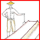
Subsistence farmers suffer not only from depleted soils but from challenges with water: too little water, too much water, and erosion from water. This field guide looks at different ways of developing barriers on farm fields for reducing the flow of water so that it can percolate into the soil and build up soil moisture. The barriers also reduce soil erosion. Topsoil suspended in water settles behind the barriers creating level terraces. These low cost/no cost techniques can be incorporated into farm fields over the span of time—spreading the workload.


This field guide includes detailed descriptions and illustrations of  barriers to water movement. Download.

 
OL 333 CSA News Update on Climate Smart Agriculture Course
Climate Smart Agriculture. Launched nine months ago, Climate Smart Agriculture has attracted course participants from North America, the Caribbean, Africa, the South Pacific, Asia, the Middle East, Latin America and Europe. Needs assessments illuminated challenges including depleted soils, access to water, flooding, and a lack of coping strategies for adapting to a changing climate.

Soil restoration  techniques, and buffering techniques against extended dry spells and unpredictable seasons were evaluated to match the most appropriate for the community’s context and their capacity for long lasting sustainability.
 
Spring Quarter Courses Begin May 7. Are you interested in:

Would you like to learn how to develop Community Based Adaptation Projects?

What’s happening in the region where you live?
Please write us with your stories, thoughts and comments through Online.Learning@csd-i.org
 
 
I look forward to hearing from you.
 
Sincerely,
 
Tim Magee, Executive Director
 
Would you like to subscribe to this newsletter?
 
The Center for Sustainable Development specializes in providing sound, evidence-based information, tools and training for humanitarian development professionals worldwide. CSDi is a 501(c)(3) nonprofit organization.


Developing a Community Level Water Conservation and Management Plan

The Importance of Community Based Watershed Restoration & Conservation

A shortage of water or unreliable access to water is one of the biggest issues in development. Community water sources dry up during climate change related drought—or seasonally during the dry season.

There is competition among different segments of the community for available water. Discussing community water challenges calls for stepping back from the immediate problem and looking at the relevant underlying causes for the shortage of water in order to begin developing solutions.

CSDi has seen a number of water related partner projects worldwide. We are seeing tremendous similarities between the projects: not enough water, too much water—and contaminated water. These challenges lead to reduced harvests, reduced income, reduced food security and nutrition, chronic ill health from waterborne disease, and flooding.

Agricultural water management addresses water challenges on the micro scale: a subsistence farmer’s fields. We look at ways of reducing runoff which had the positive benefits of both reducing erosion and keeping a valuable water on the field rather than being lost as runoff. We looked at mulches as a method of reducing evaporation—and therefore conserving our water resources. We also looked at methods of channeling water away from the farmer’s field during periods when there is an overabundance of water—and we investigated the opportunity of using dikes as a method of protecting a farmer’s field from flooding.

In Community Level Water Conservation and Management, we look at managing and conserving water at a macro level: in the community’s watersheds. In other words, in agricultural water management we work with an entire community of farmers on conserving and managing water—but at a level that is beneficial to their individual farm fields. In Community Level Water Conservation and Management, we will encouraging the same community of farmers and other community members to work together to do similar water conservation and management activities—but on a larger scale. On a larger scale from the standpoint of reforesting large-scale deforested hillsides (rather than using agroforestry techniques for their individual farm fields) and perhaps building dams to reduce erosion, flooding, and to harvest water that will benefit the entire community rather than the individual farmer.

Community Level Water Conservation and Management will benefit both the farmer through water harvesting and recharging groundwater systems, and will benefit the community at large by reducing the frequency and seriousness of floods by reforesting hillsides and plugging gullies which direct water rapidly to streams and rivers causing them to overflow suddenly and without warning.

Each of these approaches when integrated support each other creating greater resilience for community members than these could do individually.

Many of our partners’ projects assemble programs like the ones below for tackling their communities water related challenges.

Water Use Management Plan [Solution to underlying causes: Lack of Water Use Management Plan.]
[Activity 1]. Community-based workshop and survey with community members to identify their knowledge of water use and management.
[Activity 2]. Consultation with water use management expert to develop a participatory process and training program
[Activity 3]. Facilitate the Organization of a community based Water Use Management Committee
[Activity 4]. Community workshop on participatory mapping of water resources and uses, and degraded watersheds (consciousness raising)
[Activity 5]. Prioritize water springs, rivulets, ravines and man-made waterways for protection/restoration  
[Activity 6]. Investigate and develop water sourcing alternatives for the community
[Activity 7]. Investigate underlying causes of flooding and potential adaptation/mitigation actions
[Activity 8]. Committee participatory workshop on developing a community-based and implementable Water Use Management Plan

Climate Smart Agricultural Practices Programme [solution to underlying cause: Inappropriate agricultural practices – loss of traditional agricultural knowledge]:
[Activity 1]: Surveys and interviews to collect traditional knowledge on agriculture, changes in agricultural cycles, vulnerabilities and coping strategies
[Activity 2]: Identify expert specialist/extension agent in soil, water and agriculture to design and facilitate participatory workshops
[Activity 3]. Community workshop on participatory mapping of water and land resources and uses, agricultural challenges and vulnerabilities—and degraded hotspots
[Activity 4]. Extension agent visits most affected farmers to identify exact CC impacts to crop production and needs of farmers to adapt to the impacts (diseases, droughts and floods)
[Activity 5]: Develop plan that combines resilient and improved agricultural techniques with traditional knowledge for an overall improvement in productivity
[Activity 6]: Establish pilot plots demonstrating better cultivation practices
[Activity 7]: Conduct Farmer workshops on soil restoration and conservation techniques
[Activity 8]: Conduct Farmer workshops on water harvesting, conservation and management techniques

There may be substantial overlap between activities that can be used between the different programs that partners come up with.. However in order to keep focused and provide different activities and resources, we will investigate different types of activities for each program. For example, the activities you choose may be similar to these for each of the different program components.

Climate Smart Agriculture activities for Farm Fields:
-get more organic material into the soil
-use mulch on the surface of the soil
-put up barriers in the field to retard the movement of water off of the field

Water Conservation and Management Activities for Deforested Watershed:
-work with a watershed restoration expert to develop a restoration plan
-set up a tree seedling nursery in advance of the rainy season to get a stock of tree seedlings going to -be used in the reforestation plan
-identify destructive gullies that could be plugged with brushwood or loose stone check dams
-plant water loving trees along the banks of the river to reduce erosion and reduce the impact of water

What we will do to initiate the development of a plan.
We’re going to do six important things in developing a water conservation and management plan for your community.
1. Very clearly describe the highest priority, specific water related challenge that your community faces.
2. Establish a water management subcommittee to provide long-term consistency and management for a water conservation and management plan.
3. Offer a consciousness raising workshop for the subcommittee so that they can learn about the different components of a water conservation and management plan.
5. Provide consciousness raising meetings, handouts, and posters for community members about water conservation and management.
4. Develop teams that can participate in the implementation of the different activities defined in the plan.
6. Identify a highly specific activity for community members to implement and lead them in a training workshop about its implementation

How will we do this?
We will start by determining what our community member’s water related vulnerabilities are, what hazards they face, what their capacity is to implement and maintain activities, analyze what existing techniques they are successfully using and what resources are locally available. In other words we need to determine what can they do, what local resources and techniques they have available for doing these activities, and what would they be motivated to continue to do after your NGO’s sub
sidies and technical resources come to an end.

Getting Started
The first thing that we need to do is a participatory needs assessment which will evaluate the water related hazards, risks, and vulnerabilities that your community members may face—and determine if they have adopted any coping strategies to solve the challenges that they face.

We then need to look at resources that they have available for improving existing practices and exploring new ones. These resources could be in the form of and capability (capacity), human capital, land, building materials, labor, and grasses, hedges, and trees for planting in the watershed and along stream beds and shorelines.

As your ideas develop for refinements in your project design you need to consider two things. One is to seek the advice of an expert in the chosen activities who is familiar with working in your region and with your community’s culture. This expert can help you determine what will work and what will not, what activities communities are likely to maintain over a span of time—and which they’re unlikely to maintain over span of time. They can also connect you to extension services.

Two, you need to regularly share your developing activity design with the community members in an effort to make sure that you’re heading in a direction that they like, that they’re comfortable with, and that they will feel ownership in.

You also need to be thinking about the development of a water management committee if you haven’t already done that. This might not happen overnight, but it will simplify the training as the committee might have a vested interest in encouraging all members to participate.

The improvements that we make should be planned such that effort and costs don’t outweigh the benefits—and lead to eventual abandonment after project subsidies terminate. Also your project design should encourage reliance on local resources and capacities—in other words we want to reduce reliance on “giveaways” because your organizational giveaways will stop once you’re project is done.

When you’re clear about the community’s context, capacities and resources, you can begin proposing water management practices which will be meaningful for them. We will examine things like consciousness-raising, mitigation activities such as reforestation, gully plugging, and possibly even the construction of a subsurface damn in a sandy streambed. Even though you will have maintained contact with your community, once you have come up with a draft plan of the whole water management component, it will be time to present it to the community for their feedback and comments.

Developing A Disaster Risk Reduction Plan For Your Community: An Overview

It is estimated that 70% of recent disasters were related to extreme weather events—a proportion that is likely to grow as climate change processes increase the unpredictability and intensity of weather events. Because of this, disaster risk reduction should become an integral part of adaptation projects. Community based disaster risk reduction (CBDRR) holds the same merit that community based adaptation does: ownership and sustainability.

Disaster risk reduction means reducing and preventing the effects of the disaster; while disasters have always been part of history, and seem to be increasing in number, risk reduction can reduce death and suffering, the destruction of assets, and response and recovery times.

Community members with greater resources, sound housing, savings, and food reserves are at an advantage during disasters. The very poor are at a disadvantage: in the aftermath of a disaster—they frequently don’t have savings and food reserves to fall back on during a period of recovery. On top of this, the poor frequently live on marginal land which increases their risk to disaster: living on steep hillsides and suffering from mudslides during heavy rains—or living alongside a river or a coastline and suffering from flooding and shoreline erosion.

These challenges facing the poor in disaster prone regions can frequently be mitigated by using solutions from other programs within your project. For example, if your project has a climate smart agricultural component, or a food security, nutrition and home gardens component, those will reduce risk for these families by increasing resiliency through providing food reserves. If your project has a micro-enterprise or micro-savings program this will also reduce risk by providing savings to live on during a recovery period. If your project has a watershed restoration component—that can reduce flooding. As you can see there’s quite a bit of overlap between DRR and community-based adaptation.

So we’re going to begin analyzing the hazards, looking at the root causes of the hazards, clarifying the risks, exploring the existing capacity for the community to reduce risk, and looking at activities and programs that can be used to reduce risk.

Risk definitions:
Risk is the chance of injury or loss of life as defined as a measure of the probability (likelihood) and severity of an adverse effect to health, property, or the environment.

Risk analysis is the systematic use of information to identify hazards and to estimate the chance for and severity of, injury or loss to individuals or populations, property, or the environment.

Hazard is a source of potential harm, or a situation with the potential for causing harm, in terms of human injury, damage to health, property or the environment.

Hazard assessment means the identification of hazards in a given location, and is a process of estimating, for defined areas, the probabilities of the occurance of potentially damaging phenomenon of given magnitudes within a specific period of time. The purpose of hazard assessment is to specify the nature and behavior of the potential hazards and threats people face. Key hazards could include flash flood, floods, snow and wind storm, lightning, drought, and earthquakes. Secondary hazards as an outcome of key hazards could include landslides, mudslides, and snow avalanches.

Vulnerability is a set of conditions which makes people, property, infrastructure, resources, or the environment susceptible to adverse impact from a hazard events.

Response and recovery capability is defined as locally available strengths and capacities to reduce the impact of adverse conditions of the disaster. Impact severity and extent of vulnerability are dependent upon the capability or capacity to reduce the severity of impact.

Risk evaluation is the process by which risks are examined in terms of costs and benefits, and evaluated in terms of acceptability of risk considering the needs, issues, and concerns of stakeholders.

Risk reduction measure is an action intended to reduce the frequency and/or severity of injury or loss. For example: flood control mitigation or emergency response exercises.

Source: Methodology for Community-Based Hazards Vulnerability Risk Assessment in Gilgit District. Babar Khan. UNDP Regional Climate Risk Reduction Project for Himalayas (Pakistan). 2011.
http://www.wwfpak.org/gcic/pdf/Reports/2011/HVRA%20methodology%20for%20GB%20_Final__%20BK%20May%208_%202011.pdf

In the first decade of the century it was estimated that 250 million people were affected by natural disasters each year. It is expected that could rise 50% by 2015 to an average of 375 million people affected by disasters each year, in part because of climate change. Disasters are harder on poor people. In rich countries, an average of 23 people die in any given disaster; in the least developed countries this figure is 1,052. Some groups—women and girls, the chronically sick, and the elderly are even more vulnerable, their ability to cope undermined by discrimination, inequality, or poor health.

It’s not only poverty and climate change causing an increase in the number of people impacted by natural disasters. It’s also exacerbated by environmental challenges such as the deforestation of hillsides due to expanding farming activities or collecting firewood. Deforested hillsides allow for increased rainwater runoff that can lead to flooding. So, in an effort to reduce risk from suffering from disasters we need to look at a combination of poverty reduction, consciousness raising about disasters, adaptation activities, and environmental restoration.

What we will do in our analysis.
We’re going to do six important things as part of developing a disaster risk reduction plan for your community.
1. Very clearly describe the highest priority, specific hazard that your community faces.
2. Establish a CBDRR subcommittee to provide long-term consistency and management for a DRR plan.
3. Offer a consciousness raising workshop for the subcommittee so that they can learn about the different components of a DRR plan.
4. Develop teams that would provide services for the community that would range from disaster prevention to search and rescue.
5. Provide consciousness raising meetings, handouts, and posters for community members about DRR.
6. Identify a mitigation activity for community members to implement and lead them in a training workshop about its implementation

How will we do this?
We will start by determining what our community member’s vulnerabilities are, what hazards they face, what their capacity is to implement and maintain activities, analyze what existing techniques they are successfully using and what resources are locally available. In other words we need to determine what can they do, what local resources and techniques they have available for doing these activities, and what would they be motivated to continue to do after your NGO’s subsidies and technical resources come to an end.

Getting Started
The first thing that we need to do is a participatory needs assessment which will evaluate the hazards, risks, and vulnerabilities that your community members may face in a natural disaster—and determine if they have adopted any coping strategies to solve the challenges that they face.

We then need to look at resources that they have available for improving existing practices and exploring new ones. These resources could be in the form of capability (capacity), human capital, land, building materials, labor, and grasses, hedges, and trees for planting in the watershed and along stream beds and shorelines.

As your ideas develop for refinements in your project design you need to consider two things. One is to seek the advice of an expert in the chosen activities who is familiar with working in your region and with your community’s culture. This expert can help you determine what will work and what will not, what activities communities are likely to maintain over a span of time—and which they’re unlikely to maintain over span of time. They can also connect you to extension services.

Two, you need to regularly share your developing activity design with the community members in an effort to make sure that you’re heading in a direction that they like, that they’re comfortable with, and that they will feel ownership in.

You also need to be thinking about the development of a DRR committee if you haven’t already done that. This might not happen overnight, but it will simplify the training as the committee might have a vested interest in encouraging all members to participate.

The improvements that we make should be planned such that effort and costs don’t outweigh the benefits—and lead to eventual abandonment after project subsidies terminate. Also your project design should encourage reliance on local resources and capacities—in other words we want to reduce reliance on “giveaways” because your organizational giveaways will stop once you’re project is done.

When you’re clear about the community’s context, capacities and resources, you can begin proposing disaster risk reduction practices which will be meaningful for them. In the course we will examine things like consciousness-raising, mitigation activities such as reforestation, and the training of disaster teams who will assist in evacuation and search and rescue and the advent of a disaster. Even though you will have maintained contact with your community, once you have come up with a draft plan of the whole DRR component, it will be time to present it to the community for their feedback and comments.

Good Luck!