Gillian Primus (Grenada), Hanna Bartel (Canada), and Meredith Waters (US) have been working for the past year on a project on the island of Grenada; Granada that has been hit by a series of tropical hurricanes and tropical storms exhibiting increased ferocity over the past seven years. This has led to reduced crop harvests, a reduction in food security, increased malnutrition, and increased poverty.
The team originally developed this project outline to increase crop production, and are now looking for highly specific sub activities to target highly specific in-field challenges.
Their simple project outline:
Farmer Soil Conservation and Water Conservation and Management Program [Solution to underlying causes: Climate variability, extreme weather, and unpredictable rainy season have reduced crop harvests]:
[Activity 1]. Farmer workshop on soil restoration and conservation techniques
[Activity 2]. Farmer workshop on water conservation and management techniques
[Activity 3]. Participatory mapping and identification of local soil and water challenges in preparation for future implementation phase
Farmer Extension Program [Solution to underlying causes: Unpredictable/late start to rainy season; mid-season drought/early end to rainy season have reduced crop harvests.]:
[Activity 1]. Farmer workshop and follow-up on early maturing and/or drought resistant crops/varieties for adapting to climate variability
[Activity 2]. Farmer workshop and follow-up on buffering against the late arrival of rain and/or an early end to the rainy season
[Activity 3]. Participatory mapping and identification of local crop and buffering challenges in preparation for future implementation phase
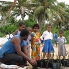
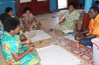
They conducted a participatory workshop to identify very specifically what the challenges are so they can begin developing sub activities for their project.
| Identification of specific project sub activities: | |
 |
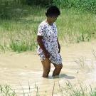
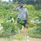
Says Gillian: “Unfortunately for us it rained throughout the entire duration of the workshop and we were able to witness firsthand — and then document through photographs — the vulnerability of these farmers.” See the photos of the flooded fields. |
| They developed a concise definition of their local climate change context and programming: | |
 |
100 subsistence farm families in the parish of St. Patrick’s (which is considered the food basket of the nation) of Grenada, are suffering from losses of and reduced crop harvests due to extreme weather, an unpredictable rainy season, and extended periods of drought. This is leading to a reduction of food security, increased malnutrition, and increased poverty. |
|
The farmers’ fields are situated on flat and sloping lands. Given the soil composition; mainly clay based and the unseasonal rainfall and periods of prolonged dry spells, they are prone to drought like conditions, severe flooding (river overflowing its banks, heavy runoff from the slopes) and erosion and depletion of the soil. |
|
Dual challenge– drought and flooding: This team working on a project in Grenada is currently developing sub activities for their project that on the one hand will help farmers during drought conditions — and on the other hand can protect the fields from flooding.
You can download the participatory mapping for their project here:
OL 333 assignment one how-to card.
You can download their full project outline here:
OL 343 assignment five
Here are some of the techniques that they’re investigating:
Drought and rain related to erosion:
get more organic material into the soil by incorporating crop residues back into the soil prior to planting
use crop residues to mulch on the surface of the soil so that it is not so exposed and also for increasing the organic material content of the soil
collecting organic material and making compost piles (this was mentioned in Tim’s example and seems to be a valuable addition to the process)
building barriers in the field to retard the movement of water off of the field
contour ridges
soil bunds digging a retention pond
making raised planting beds
Agricultural techniques for high rainfall and flooded areas
Wet Watershed Management Guide: Water Harvesting and Soil Conservation in High Rainfall Areas
agroforestry/alley cropping
contour farming
mixed cropping
deep bedding system
gully plugging – earthen gully plugs
graded bunds
field bunds
protection bunds
farm ponds
drainage channels and culverts
diversion channels
land reclamation and vegetative measures
Farming techniques for flooding in flat lands
Parallel field ditches are excellent for agricultural drainage on flatter types of lands, and are also used as to prevent erosion on sloping farm lands. Water from the field ditches is drained away into side ditches. The side ditches then carry water to an outlet channel. Surface drainage is important in farm areas as it prevents many water-related land problems and ensures that crops do not become waterlogged. www.wisegeek.com/what-is-surface-drainage.htm
Deep Bedding Systems for Improved Drainage Description:
Digging deep drains and piling the excavated soil between the drains give rise to deep beds 2-2.5 ft high which may necessitate the construction of side walls. Breaking up the soil manually to a fine tilt is next followed by the incorporation of organic matter to improve soil fertility and structure. Can be labor intensive. Good DRM practices for Belizean small farmers
Next week they will be making the final selection of the sub activities and presenting them to the community members.
Do you have any suggestions for their project?
Would you like to learn how to develop Community Based Adaptation Projects?
Please write us with your stories, thoughts and comments through Online.Learning@csd-i.org


